#4 CERERE

TECH PROFILE
SMART FARMING FOR LABOUR SUPPORT
Software
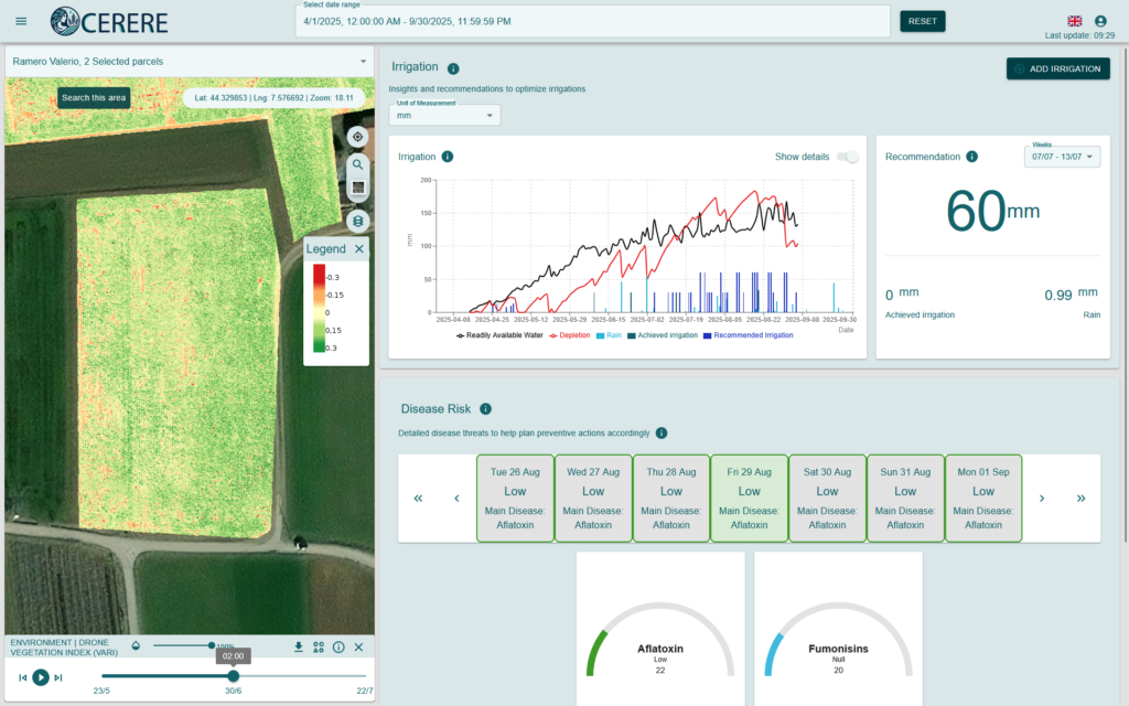
This platform is a pioneering Decision Support System (DSS) designed to enhance sustainable agriculture by addressing critical farming challenges, including water scarcity, crop disease, and vegetation stress. It is user-friendly and data-driven, able to integrate several data sources, including in-field observations, weather data, and Earth observation data from Copernicus.
The platform features AI-based crop monitoring models and can be used as a decision-support system to help with farm management.
KEY FEATURES & INNOVATION
- Optimal irrigation management: It uses a water balance model to determine precise irrigation needs and recommend the optimal water supply to keep crops healthy and productive.
- Disease risk monitoring: It analyses measured and forecasted weather data to predict conditions that may foster crop diseases, such as mycotoxins in maize and botrytis in strawberries, and provides a daily risk index with a two-week forecast horizon.
- Remote vegetation health monitoring: It uses satellite images to detect early signs of plant stress across entire fields, reducing anual inspection and lowering costs.
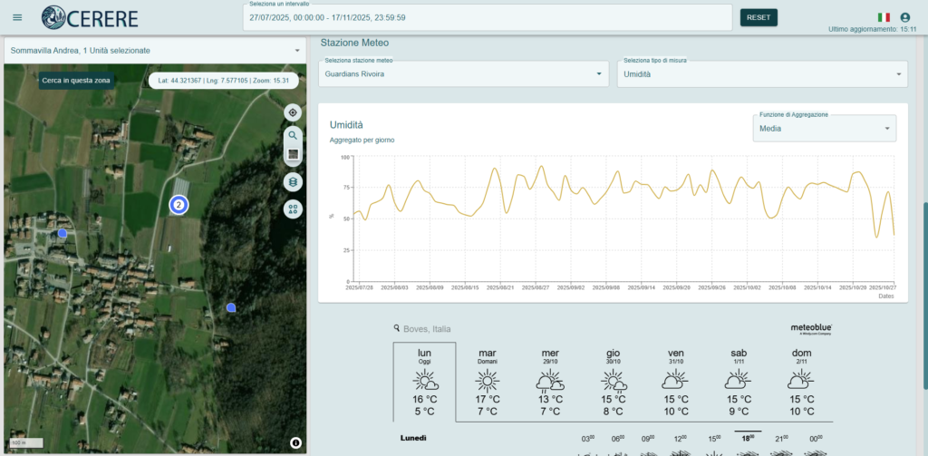
- Weather data integration: Itntegrates data from local weather stations and weather forecasts to provide realtime insights to farmers, including current and forecasted temperature, humidity, precipitation, and wind conditions.

BENEFITS
- Timely and informed decision-making: Data-driven tools help farmers face environmental challenges and adapt to climate variability.
- Crop management optimisation: CERERE blends traditional farming with precision agriculture to improve resource use and crop health monitoring.
- Sustainable practices: Predictive analytics guide farmers toward efficient farming.
ACCESSIBILITY
CERERE’s main interface includes a responsive web application, with a customised design for mobile devices, that includes a map view with key vegetative indexes like the NDVI (Normalised Difference Vegetation Index) to assess crop vigour, and a dashboard that enables easy and effective visualisation of irrigation, disease and weather-related data.